NASA Acres Scientists are Developing Methods to Delineate High Resolution Field Boundaries
December 4, 2023 - Written By Nicole Pepper
Agricultural crop field sizes are indicative of many factors, such as the degree of agricultural capital investment, mechanization, and labor intensity. Delineated field boundaries, combined with other data, can provide field-level information (e.g. on field size, fertilizer use, productivity) that is more useful than the conventional pixel-level information for agricultural decision making, e.g. regarding land use planning and resources allocation.
NASA Acres scientists, David Roy and Lin Yan of Michigan State University, are taking a computer-vision approach to extract crop field objects from Landsat satellite time series wall-to-wall in the Conterminous United States (CONUS) annually for 2008-2026, with core processing undertaken in Amazon Web Services (AWS) where the USGS Collection 2 Landsat Analysis Ready Data (ARD) are stored, and the results will be validated using Google-Earth and NASA high spatial-resolution imagery. In areas where fields are too small to be extracted reliably from Landsat 30m images, the commercial high-resolution images will be considered.
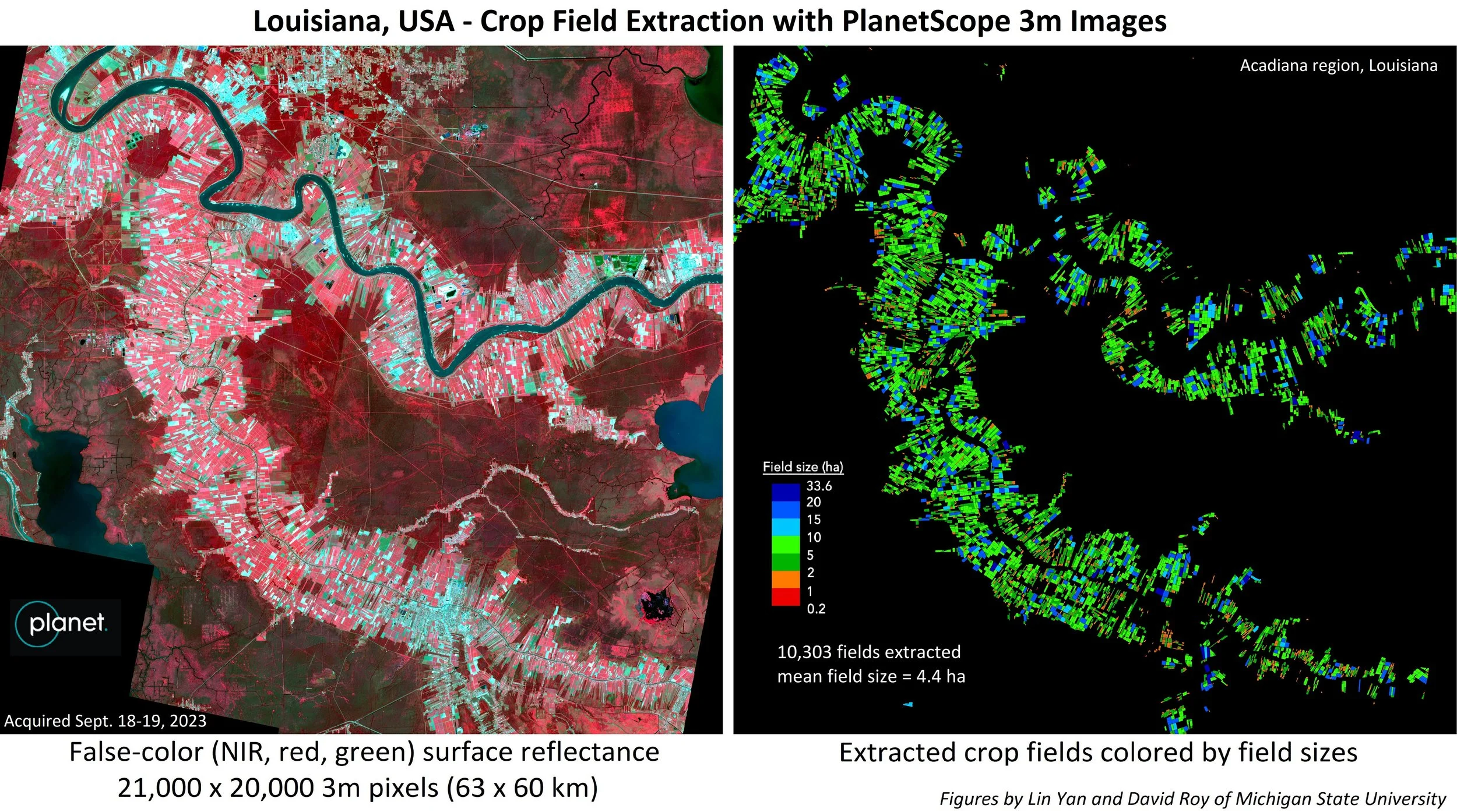
The above satellite images highlight their preliminary results of such an example in the Acadiana region in Louisiana where the fields (most planted with sugarcane) are relatively small, incorporating the PlanetScope 3m imagery for field extraction. A new set of computer-vision algorithms were used, which were developed under an ongoing project of the NASA Land Cover Land Use Change (LCLUC) Program to extract crop fields in smallholder regions in Asia using commercial high-resolution satellite imagery. The figure on the left shows the study area in Louisiana visualized using the near infrared, red, and green false-color band combination which is useful for seeing variations in vegetation, displaying vegetated land in shades of red, exposed ground in more of a grey/green, and water in black and blue. The figure on the right shows the extracted field objects colored by the field sizes as small, median, large (see details in the color legend). The PlanetScope imagery with 3m spatial resolution was successful at extracting fields that are smaller than 2 hectares which are difficult to be reliably extracted from Landsat 30m imagery alone (2 hectares correspond to about 22 pixels with 30m resolution).

