Advancing Application of Enhanced Vegetation Index Data Products in the U.S. National Greenhouse Gas Inventory
Project Summary
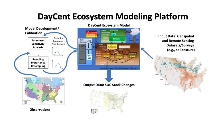
The DayCent ecosystem model is used by the U.S. National Government for reporting greenhouse gas (GHG) emissions from agricultural lands to the U.N. Framework Convention on Climate Change. This project will enhance reporting by extending the time series of Enhanced Vegetation Index (EVI) Data for simulating crop and grassland forage production in the model. Accurate representation of this process is critical for estimating C inputs to soil C pools, and estimating the impact of N uptake by crops and forages on nitrification and denitrification. We will test several satellite-based products for extending the time series beyond the coverage from MODIS, and then calibrate the light-use efficiency algorithm in DayCent using Bayesian methods with the new dataset. Independent data will be used to assess the accuracy of production estimates from the calibrated model. The new EVI data product will be used to drive DayCent simulations and estimate soil C stock changes and soil nitrous oxide emissions for croplands with major commodity crops as well as grasslands in the conterminous United States.
Study Area:
United States
Earth Observations Used
MODIS | VIIRS | Sentinel-3
Other Collaborators:
United States Department of Agriculture
Lead Institution
Project Lead
Stephen Ogle
Colorado State University
Project Team:
Shannon Spencer
Colorado State University
Alisa Keyser
Colorado State University
Ryan Scheiderer
Colorado State University


