Exploring Satellite EO to Support Rangeland Health and Productivity
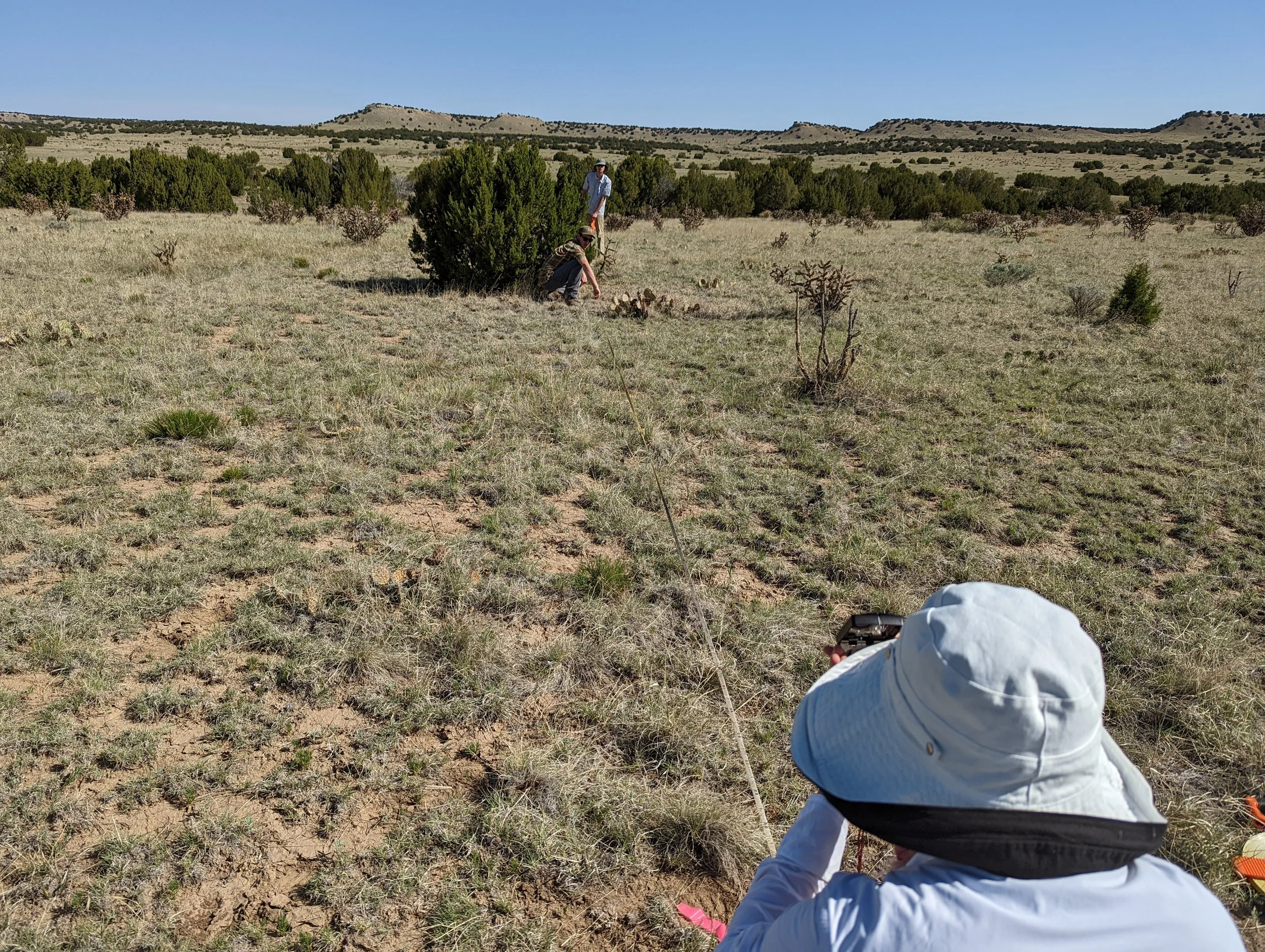
Photo of the Colorado State University team measuring rangeland cover to calibrate remotely sensed imagery
Project Summary
Rangelands provide critical ecological, economic, and social functions yet they are threatened by changing land use, changes in weather and atmospheric conditions, challenging economics, and other factors. There are some opportunities for EO to contribute to solutions. For example, EO can be used to monitor rangeland conditions which can be used to understand trends over time and drivers of rangeland health, detect issues early, evaluate, document, and share the effectiveness of management approaches, provide evidence of management outcomes for ecosystem service markets, and to adapt management approaches. EO has the potential to improve economic returns on rangelands through improved sustainability of operations, supporting decisions optimized to environmental conditions (e..g., matching cattle nutritional needs to forage quality), and providing early indicators and signals for preparedness in decision making (e.g., when to destock).
Satellite observations offer great potential to improve social, economic, and environmental outcomes on rangelands by providing low-cost, near real time monitoring information to inform proactive management and response to changes in weather and atmospheric conditions change and extreme weather events. While more rangeland decision support tools using satellite imagery are emerging, adoption of these tools by ranchers is relatively low for reasons such as: a) unfamiliarity with Earth observations, their interpretation, or applicability to decision support; (b) lack of accuracy, availability, or relevance to local contexts; and c) lack of demonstrated benefit to social, economic, and environmental well-being. Drs. Vorster, Machmuller, and Evangelista at Colorado State University are working with ranchers and associated organizations across a variety of ecosystems in the arid western U.S. to understand the most impactful opportunities for remote sensing to support rangeland management and develop use cases for the application of satellite EO to rangeland and ranch management. These use cases will evaluate the capabilities of remote sensing to detect rangeland ecosystem stability (i.e., resilience, resistance, variability), which will then be used to evaluate the impact of grazing management practices on ecosystem stability. The team will also explore how satellite Earth observations can improve soil carbon monitoring by providing model inputs that capture heterogeneous landscape conditions. Additional research will focus on evaluating and improving herbaceous biomass maps on rangelands across ecosystems to develop products that can more reliably be used to inform adaptive rangeland management.
Study Area:
Colorado | New Mexico | Oklahoma
Earth Observations Used
Landsat OLI | Sentinel-2 MSI
Lead Institution
Project Leads
Tony Vorster
Colorado State University
Project Team:
Megan Machmuller
Colorado State University
Paul Evangelista
Colorado State University
Daniel Cleveland
Colorado State University
Nick Young
Colorado State University
News:
Other Collaborators
JJ Autry The Nature Conservancy
Tom Sidwell JX Ranch
Sean Kearney USDA-Agricultural Research Service
Keith Paustian Soil and Crop Sciences, CSU
Retta Bruegger CSU Extension

